 Effective prevention and response to conflict requires informed strategy and policy-making to fully understand the drivers of instability, the key actors, and the changing dynamics of a given context. Informed strategy and policy-making relies on robust data that can identify warning signals and demonstrate trends. For two decades, FFP has been developing innovative tools to aid practitioners in addressing conflict and instability.
Perhaps best known among FFP’s initiatives to improve the availability and use of conflict early warning data is the Fragile States Index, a critical tool in highlighting not only the normal pressures that all states experience, but also in identifying how those pressures change over time. By highlighting pertinent vulnerabilities which contribute to the risk of state fragility, the Index — and the social science framework and the data analysis tools upon which it is built — makes political risk assessment and early warning of conflict accessible to policy-makers and the public at-large. The strength of FSI is its ability to distill millions of pieces of information into a form that is relevant as well as easily digestible and informative. FFP combines thousands of reports and information from around the world with dozens of quantitative datasets, detailing the existing social, economic, political, and cross-cutting pressures faced by 178 countries.
The FSI also demonstrates FFP’s ability to successfully use mixed methods research approaches, integrating content analysis with qualitative and quantitative data. These varied technological approaches employed by FFP include:
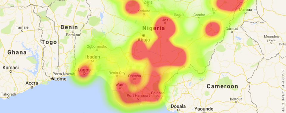
FFP specializes in conflict mapping and geospatial data analysis and has used this expertise to support several projects. For example, FFP built an online Peace Map that integrates more than 24,000 conflict incidents in Nigeria and lists more than 650 Peace Agents. The Peace Map aims to strengthen local participatory conflict assessment and has allowed FFP’s local partners to address various conflict issues in the Niger Delta. The creation of the Peace Map has allowed FFP to produce studies, briefs, and trackers on conflict trends in the Niger Delta, helping to fill in knowledge gaps on the part of the donor community and public-sector stakeholders.
FFP has conducted stakeholder network analysis of institutional networks at a national, regional, and continental level in an effort to understand the effects of different network characteristics, pinpoint key gaps, and identify leverage points where small changes can have outsized effects. As part of a project on preventing election violence in Nigeria, FFP mapped nearly 280 organizations involved in that broader effort. From that map, FFP analyzed the presence and characteristics of the network in Nigeria’s 36 states and how it affected election violence during the 2015 electoral cycle. FFP also mapped nearly 650 organizations working across West Africa to help inform the engagement of the Economic Community of West African States with civil society in the region and mapped over 1,500 organizations involved in youth initiatives to inform the planning and interventions of the Open Society Foundation.
FFP’s role on the USAID-funded Reacting to Early Warning and Response Data (REWARD) project, a program which has followed from FFP’s successful work in successful work in Nigeria, Liberia, and Uganda, involves helping national and local level stakeholders create comprehensive, inclusive early warning and response systems. As the technical partners on the project, FFP has conducted complex mixed methods research, utilizing quantitative and qualitative desktop research to inform fieldwork, to support of the production of final Country Risk and Vulnerability Assessments for each of the 15 ECOWAS states.
Click Here to Request Our Assistance on Using Data for Conflict Early Warning.
